Author: ARAB NEWSSun, 2018-01-21 03:00ID: 1516485251966546900
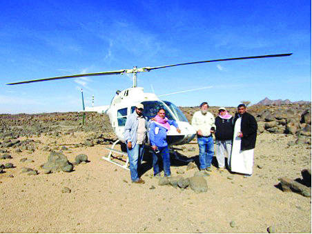
JEDDAH: Chairman of the Saudi Geological Survey Zohair A. Nawab has revealed that a specialized team of the SGS have visited Khybar volcanic and stony area to look at evidence of strong earthquakes.
Seismic records indicate that earthquakes here date back about 1,500 years. No historical seismic records were documented before this time. This prompted the specialists to visit and find out the effects of earthquakes on archaeological sites.
The area harbors an ancient temple with thousands of ancient tombs along a line leading to an area of animal fisheries.
Nawab noted that the evidence indicates earthquakes thousands of years ago that damaged the temple and ancient graves.
These observations were documented during a visit to the site in the early 1980s. A brief description of these evidences was included in the 1991 report (geological map GM-131).
Hani Zahran, director general of the National Center for Earthquakes and Volcanoes at the SGS, said the team had found five sites around the Khybar volcanic area.
The first site is a quadrilateral ancient temple that dates back 6,000 years. It has an open space accessed by stairs, believed to have been used to worship the sun and the moon before Islam.
Zahran said the study of the archaeological buildings affected by these earthquakes can determine when the earthquakes occurred. These studies are important for preparing hazard maps and submitting them to decision-makers to take into account when making urban expansion plans.
The village of Al-Ain is particularly important for the existence of two temples, the oldest of which has been turned into rubble by an earthquake.
Nawab said the site can be used as a museum to reflect the Kingdom’s civilization.
There are oases in Khybar surrounded by defensive walls built of basalt blocks. These walls have also been damaged by an earthquake. On the eastern side of Khybar volcanic area, two archaeological centers were found in the cities of Al-Hait and Al-Huait.
The old walls surrounding the oases were recently repaired by building mud-brick walls over the remaining basalt walls. Lines of stone tombs of various shapes are spread around the old Al-Hait village.
The destruction of a prominent building was observed about 7km southwest of Al-Hait. It turned into a pile of basalt blocks.
On the northern side of the border wall there is a control tower outside the wall.
Then the SGS team headed south-east to examine six mountain sites with ancient drawings carved on sandstone rocks inside the volcanic field.
The SGS team then headed to the three dams built between 660AD and 680AD. These dams were apparently destroyed at the same time in the Tectonic earthquake of March 1068, the center of which is between Khybar volcanic area and Tayma.
“Khybar site may be the largest surviving area of the modern Bronze Stone Age in the world,” Zohair said.
These sites deserve to be a center of world heritage. And they will help assess future risks for urban expansion and modern infrastructure in Saudi Arabia.

 Main category: Saudi ArabiaArt & CultureTags: Saudi Geological Survey (SGS)Saudi Arabiarelated_nodes: Saudi Geological Survey plans to offer raw mineral exploitation projects to private sectorSaudi geologist returns from Antarctica
[contf] [contfnew] 
Arab News
[contfnewc] [contfnewc]


